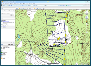
| While at this time, Map My Land™ does not offer a way to overlay a property map onto a topo map within the software itself, there is a way to do this using Google Earth. Instructions are shown below. |
USGS Topo Maps in Google Earth
In Google, search for “topomaps.kmz”.
Look for the following search result and click on it
Download that file by clicking on the link. Make a note of the location to which you downloaded the file.
Open Google Earth and click on File/Open
in the main menu.
Navigate to the folder where you put the topomaps.kmz file.
Click on topomaps.kmz and press ok.
In Google Earth you’ll see an entry under Places for “USGS Topo Maps”
Drag that entry up to My Places.
Check the checkbox to the left of USGS Topo Maps when you want to see the topo and uncheck it when you don’t want to see the topo.
In Map My Land ™, open the file you wish to overlay.
Click on the GPS tab and then on Export to Google Earth. (You will not be able export to Google Earth if you do not have the latitude and longitude information for your property map.)
Google Earth will display your property boundary first.
 Check the checkbox for USGS Topo Maps. After a few seconds, Google Earth will display the map as you see it here. The gray arrows mean that it is loading the topo map.
 In a few more seconds, Google Earth will display the topo map behind the boundary map.


